Measuring household carbon

Allinson, D., Irvine, K.N., Edmondson, J.L., Tiwary, A., Hill, G., Morris, J., Bell, M., Davies, Z.G., Firth, S.K., Fisher, J., Gaston, K.J., Leake, J.R., McHugh, N., Namdeo, A., Rylatt, M. & Lomas, K. (2016) Measurement and analysis of household carbon: The case of a UK city. Applied Energy 164, 871-881. (Image from Shutterstock)shutterstock_85565086

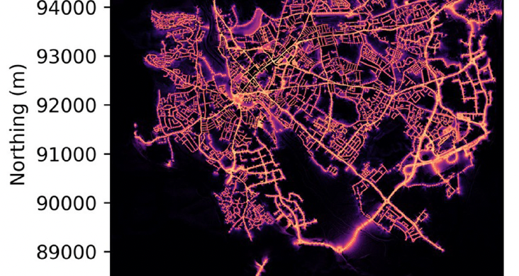
There is currently a lack of data recording the carbon and emissions inventory at household level. This paper presents a multi-disciplinary, bottom-up approach for estimation and analysis of the carbon emissions, and the organic carbon (OC) stored in gardens, using a sample of 575 households across a UK city. The annual emission of carbon dioxide emissions from energy used in the homes was measured, personal transport emissions were assessed through a household survey and OC stores estimated from soil sampling and vegetation surveys. The results showed that overall carbon patterns were skewed with highest emitting third of the households being responsible for more than 50% of the emissions and around 50% of garden OC storage. There was diversity in the relative contribution that gas, electricity and personal transport made to each household’s total and different patterns were observed for high, medium and low emitting households. Targeting households with high carbon emissions from one source would not reliably identify them as high emitters overall. While carbon emissions could not be offset by growing trees in gardens, there were considerable amounts of stored OC in gardens which ought to be protected. Exploratory analysis of the multiple drivers of emissions was conducted using a combination of primary and secondary data. These findings will be relevant in devising effective policy instruments for combatting city scale green-house gas emissions from domestic end-use energy demand.


UAVs for wildlife conservation

Gonzalez, L.F., Montes, G.A., Puig, E., Johnson, S., Mengersen, K. & Gaston, K.J. (2016) Unmanned Aerial Vehicles (UAVs) and Artificial Intelligence revolutionizing wildlife monitoring and conservation. Sensors 16(1), 97. (Image from Shutterstock) shutterstock_188506913

Surveying threatened and invasive species to obtain accurate population estimates is an important but challenging task that requires a considerable investment in time and resources. Estimates using existing ground-based monitoring techniques, such as camera traps and surveys performed on foot, are known to be resource intensive, potentially inaccurate and imprecise, and difficult to validate. Recent developments in unmanned aerial vehicles (UAV), artificial intelligence and miniaturized thermal imaging systems represent a new opportunity for wildlife experts to inexpensively survey relatively large areas. The system presented in this paper includes thermal image acquisition as well as a video processing pipeline to perform object detection, classification and tracking of wildlife in forest or open areas. The system is tested on thermal video data from ground based and test flight footage, and is found to be able to detect all the target wildlife located in the surveyed area. The system is flexible in that the user can readily define the types of objects to classify and the object characteristics that should be considered during classification.


Warming temperatures and phytoplankton productivity

Yvon-Durocher, G., Allen, A. P., Cellamare, M., Dossena, M., Gaston, K. J., Leitao, M., Montoya, J. M., Reuman, D. C., Woodward, G. & Trimmer, M. (2015) Five Years of Experimental Warming Increases the Biodiversity and Productivity of Phytoplankton. PLoS Biology 13(12): e1002324. (Image from Shutterstock) shutterstock_309631616

Phytoplankton are key components of aquatic ecosystems, fixing CO2 from the atmosphere through photosynthesis and supporting secondary production, yet relatively little is known about how future global warming might alter their biodiversity and associated ecosystem functioning. Here, we explore how the structure, function, and biodiversity of a planktonic metacommunity was altered after five years of experimental warming. Our outdoor mesocosm experiment was open to natural dispersal from the regional species pool, allowing us to explore the effects of experimental warming in the context of metacommunity dynamics. Warming of 4°C led to a 67% increase in the species richness of the phytoplankton, more evenly-distributed abundance, and higher rates of gross primary productivity. Warming elevated productivity indirectly, by increasing the biodiversity and biomass of the local phytoplankton communities. Warming also systematically shifted the taxonomic and functional trait composition of the phytoplankton, favoring large, colonial, inedible phytoplankton taxa, suggesting stronger top-down control, mediated by zooplankton grazing played an important role. Overall, our findings suggest that temperature can modulate species coexistence, and through such mechanisms, global warming could, in some cases, increase the species richness and productivity of phytoplankton communities.


Spatial features of Protected Areas

Durán, A. P., Inger, R., Cantú‐Salazar, L. & Gaston, K. J. (2015) Species richness representation within protected areas is associated with multiple interacting spatial features. Diversity and Distributions, in press. DOI: 10.1111/ddi.12404. (Image from Shutterstock) shutterstock_258166631

We assessed the relative effects of the spatial features of protected areas (PAs), and their interactions, on species richness representation. We used a novel dataset comprising species richness estimates for amphibians, birds and mammals for more than 400 PAs in the Western Hemisphere. Using spatial tools and remote sensing imagery, we calculated four spatial features for each PA: size, shape index, fragmentation level and proximity to the closest PA. The relative effect size of both PA spatial features and environmental covariates on levels of species richness, and how they interact, were assessed using generalized mixed effect models. Spatial features and environmental covariates explained about 61% of the variation in species richness within PAs, with the magnitude of the effect remaining similar among spatial features and taxonomic groups. While area had a positive effect on species richness, shape index and fragmentation had negative effects. Proximity had a significant positive effect only for mammals and a negative effect for all the taxa combined. PA spatial features showed significant interactions between them and with environmental covariates. We provide the first empirical evidence for the combined and interactive effects of terrestrial PA spatial features on predicting species richness. Our results suggest that the spatial features of PAs have an important effect on species richness and while the magnitude of this effect varies across taxonomic groups, its direction is consistent. Additionally, we show that the effect of one spatial design feature can be amplified or attenuated by that of another. These findings contribute towards a better understanding of the effect of spatial features on the performance of PAs and therefore how best to enhance the spatial configuration of existing and future PAs.


Horizon scanning for urban ecosystems

Stanley, M.C., Beggs, J.R., Bassett, I.E., Burns, B.R., Dirks, K.N., Jones, D.N., Linklater, W.L., Macinnis-Ng, C., Simcock, R., Souter-Brown, G., Trowsdale, S.A. & Gaston, K.J. (2015) Emerging threats in urban ecosystems: a horizon scanning exercise. Frontiers in Ecology and the Environment 13(10): 553–560. (Image from Shutterstock) shutterstock_115045105

As urbanization intensifies, urban ecosystems are increasingly under pressure from a range of threats. Horizon scanning has the potential to act as an early warning system, thereby initiating prompt discussion and decision making about threat mitigation. We undertook a systematic horizon scanning exercise, using a modified Delphi technique and experts from wide-ranging disciplines, to identify emerging threats in urban ecosystems. The 10 identified threats were generally associated with rapid advances in technology (eg solar panels, light-emitting diode lights, self-healing concrete) or with societal demands on urban nature (eg green prescriptions). Although many of the issues identified are also technological opportunities with recognized environmental benefits, we have highlighted emerging risks so that research and mitigation strategies can be initiated promptly. Given the accelerated rate of technological advancement and the increasing demands of urbanized populations, horizon scanning should be conducted routinely for urban ecosystems.


Songbirds and connecting people to nature

Cox, D.T.C. & Gaston, K.J. (2015) Likeability of garden birds: importance of species knowledge & richness in connecting people to nature. PLoS ONE 10(11), e0141505. (Image from Shutterstock) shutterstock_149233118

Interacting with nature is widely recognised as providing many health and well-being benefits. As people live increasingly urbanised lifestyles, the provision of food for garden birds may create a vital link for connecting people to nature and enabling them to access these benefits. However, it is not clear which factors determine the pleasure that people receive from watching birds at their feeders. These may be dependent on the species that are present, the abundance of individuals and the species richness of birds around the feeders. We quantitatively surveyed urban households from towns in southern England to determine the factors that influence the likeability of 14 common garden bird species, and to assess whether people prefer to see a greater abundance of individuals or increased species richness at their feeders. There was substantial variation in likeability across species, with songbirds being preferred over non-songbirds. Species likeability increased for people who fed birds regularly and who could name the species. We found a strong correlation between the number of species that a person could correctly identify and how connected to nature they felt when they watched garden birds. Species richness was preferred over a greater number of individuals of the same species. Although we do not show causation this study suggests that it is possible to increase the well-being benefits that people gain from watching birds at their feeders. This could be done first through a human to bird approach by encouraging regular interactions between people and their garden birds, such as through learning the species names and providing food. Second, it could be achieved through a bird to human approach by increasing garden songbird diversity because the pleasure that a person receives from watching an individual bird at a feeder is dependent not only on its species but also on the diversity of birds at the feeder.


LiDAR for vegetation modelling

Anderson, K., Hancock, S., Disney, M. & Gaston, K.J. (2015) Is waveform worth it? A comparison of LiDAR approaches for vegetation and landscape characterization. Remote Sensing in Ecology and Conservation, in press. (Image from Shutterstock) shutterstock_95030080

Light Detection and Ranging (LiDAR) systems are frequently used in ecological studies to measure vegetation canopy structure. Waveform LiDAR systems offer new capabilities for vegetation modelling by measuring the time-varying signal of the laser pulse as it illuminates different elements of the canopy, providing an opportunity to describe the 3D structure of vegetation canopies more fully. This article provides a comparison between waveform airborne laser scanning (ALS) data and discrete return ALS data, using terrestrial laser scanning (TLS) data as an independent validation. With reference to two urban landscape typologies, we demonstrate that discrete return ALS data provided more biased and less consistent measurements of woodland canopy height (in a 100% tree covered plot, height underestimation bias = 0.82 m;SD = 1.78 m) than waveform ALS data (height overestimation bias = −0.65 m; SD = 1.45 m). The same biases were found in suburban data (in a plot consisting of 100% hard targets e.g. roads and pavements), but discrete return ALS were more consistent here than waveform data (SD = 0.57 m compared to waveform SD = 0.76 m). Discrete return ALS data performed poorly in describing the canopy understorey, compared to waveform data. Our results also highlighted errors in discrete return ALS intensity, which were not present with waveform data. Waveform ALS data therefore offer an improved method for measuring the three-dimensional structure of vegetation systems, but carry a higher data processing cost. New toolkits for analysing waveform data will expedite future analysis and allow ecologists to exploit the information content of waveform LiDAR.


IUCN Red List assessment: Cactaceae

Goettsch, B., Hilton-Taylor, C., Cruz-Piñón, G., Duffy, J.P., Frances, A., et al. (2015) High proportion of cactus species threatened with extinction. Nature Plants 1, 15142. (Image from Shutterstock) shutterstock_134963513

A high proportion of plant species is predicted to be threatened with extinction in the near future. However, the threat status of only a small number has been evaluated compared with key animal groups, rendering the magnitude and nature of the risks plants face unclear. Here we report the results of a global species assessment for the largest plant taxon evaluated to date under the International Union for Conservation of Nature (IUCN) Red List Categories and Criteria, the iconic Cactaceae (cacti). We show that cacti are among the most threatened taxonomic groups assessed to date, with 31% of the 1,478 evaluated species threatened, demonstrating the high anthropogenic pressures on biodiversity in arid lands. The distribution of threatened species and the predominant threatening processes and drivers are different to those described for other taxa. The most significant threat processes comprise land conversion to agriculture and aquaculture, collection as biological resources, and residential and commercial development. The dominant drivers of extinction risk are the unscrupulous collection of live plants and seeds for horticultural trade and private ornamental collections, smallholder livestock ranching and smallholder annual agriculture. Our findings demonstrate that global species assessments are readily achievable for major groups of plants with relatively moderate resources, and highlight different conservation priorities and actions to those derived from species assessments of key animal groups.


Artificial light and food webs

shutterstock_312278753

Image from shutterstock

Sanders, D., Kehoe, R., Tiley, K., Bennie, J., Cruse, D., Davies, T.W., van Veen F.J.F. & Gaston, K.J. (2015) Artificial nighttime light changes aphid-parasitoid population dynamics. Scientific Reports 5, 15232.

Artificial light at night (ALAN) is recognized as a widespread and increasingly important anthropogenic environmental pressure on wild species and their interactions. Understanding of how these impacts translate into changes in population dynamics of communities with multiple trophic levels is, however, severely lacking. In an outdoor mesocosm experiment we tested the effect of ALAN on the population dynamics of a plant-aphid-parasitoid community with one plant species, three aphid species and their specialist parasitoids. The light treatment reduced the abundance of two aphid species by 20% over five generations, most likely as a consequence of bottom-up effects, with reductions in bean plant biomass being observed. For the aphid Megoura viciae this effect was reversed under autumn conditions with the light treatment promoting continuous reproduction through asexuals. All three parasitoid species were negatively affected by the light treatment, through reduced host numbers and we discuss induced possible behavioural changes. These results suggest that, in addition to direct impacts on species behaviour, the impacts of ALAN can cascade through food webs with potentially far reaching effects on the wider ecosystem.

Download pdf


Land-sparing, land-sharing and use of urban greenspace

Soga, M., Yamaura, Y., Aikoh, T., Shoji, Y., Kubo, T. & Gaston, K.J. (2015) Reducing the extinction of experience: Association between urban form and recreational use of public greenspace. Landscape and Urban Planning 143, 69-75.shutterstock_309919712
(Image from Shutterstock)

Halting the ‘extinction of experience’, the progressive disengagement of people with the natural world, is vital to human health and wellbeing and to public support for global biological conservation. Home to the majority of humanity, urban areas are the key for engaging people with nature, raising the crucial question of how cities should best be designed to facilitate these experiences. For the purposes of maintaining local biodiversity, intensive development within a small area (land sparing) has been shown to be better than extensive development over a large area (land sharing). Here, we investigated for the first time how different city forms affect people’s experience of nature, measured in terms of their use of greenspaces. We selected five pairs of land-sharing and land-sparing study regions with different coverage by greenspaces within the city of Tokyo, central Japan and used a questionnaire survey to determine the use residents made of these spaces. We found the frequency of people’s recreational use of urban greenspaces was higher in urban land-sharing than land-sparing regions. Moreover, satisfaction with local green environments was also higher in land-sharing regions. This suggests a potential conflict in the design of cities between the urban form that is most desirable for the direct protection of regional biodiversity, and that which best promotes people’s nature experiences and the support for its wider protection. A strong emphasis on the advantages of land sparing may increase the separation of humans from nature, and further reduce public interest in, and awareness of, biodiversity and its benefits.